
File:Usa edcp relief location map.png

本预览的尺寸:800 × 495像素。 其他分辨率:320 × 198像素 | 640 × 396像素 | 1,181 × 731像素。
原始文件 (1,181 × 731像素,文件大小:1.56 MB,MIME类型:image/png)
Any autoconfirmed user can overwrite this file from the same source. Please ensure that overwrites comply with the guideline.
摘要
| 描述 |
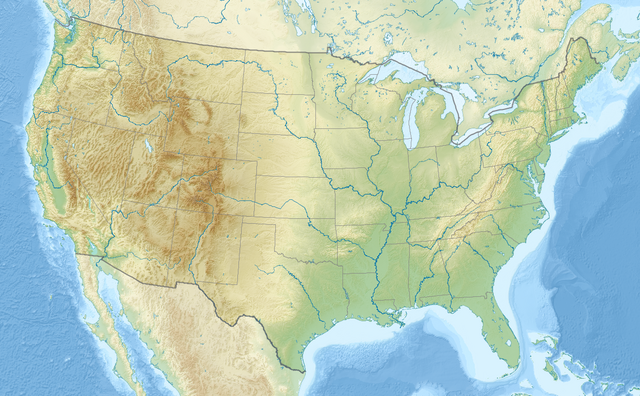
English: Relief location map of the USA (without Hawaii and Alaska).
EquiDistantConicProjection : Central parallel : * N: 37.0° N Central meridian : * E: 96.0° W Standard parallels: * 1: 32.0° N * 2: 42.0° N Made with Natural Earth. Free vector and raster map data @ naturalearthdata.com. Formulas for x and y: x = 50.0 + 124.03149777329222 * ((1.9694462586094064-({{{2}}}* pi / 180))
* sin(0.6010514667026994 * ({{{3}}} + 96) * pi / 180))
y = 50.0 + 1.6155950752393982 * 124.03149777329222 * 0.02613325650382181
- 1.6155950752393982 * 124.03149777329222 *
(1.3236744353715044 - (1.9694462586094064-({{{2}}}* pi / 180))
* cos(0.6010514667026994 * ({{{3}}} + 96) * pi / 180))
|
| 日期 | |
| 来源 | 自己的作品 |
| 作者 | Uwe Dedering |
| 其他版本 |
|

许可协议
我,本作品著作权人,特此采用以下许可协议发表本作品:
本文件采用知识共享署名-相同方式共享 3.0 未本地化版本许可协议授权。
- 您可以自由地:
- 共享 – 复制、发行并传播本作品
- 修改 – 改编作品
- 惟须遵守下列条件:
- 署名 – 您必须对作品进行署名,提供授权条款的链接,并说明是否对原始内容进行了更改。您可以用任何合理的方式来署名,但不得以任何方式表明许可人认可您或您的使用。
- 相同方式共享 – 如果您再混合、转换或者基于本作品进行创作,您必须以与原先许可协议相同或相兼容的许可协议分发您贡献的作品。

|
已授权您依据自由软件基金会发行的无固定段落及封面封底文字(Invariant Sections, Front-Cover Texts, and Back-Cover Texts)的GNU自由文件许可协议1.2版或任意后续版本的条款,复制、传播和/或修改本文件。该协议的副本请见“GNU Free Documentation License”。 |
您可以选择您需要的许可协议。
文件历史
点击某个日期/时间查看对应时刻的文件。
| 日期/时间 | 缩略图 | 大小 | 用户 | 备注 | |
|---|---|---|---|---|---|
| 当前 | 2024年4月2日 (二) 20:50 | | 1,181 × 731(1.56 MB) | Spesh531 | correction to Rhode Island border. Little Compton and Tiverton was previously shown to be in Massachusetts |
| 2016年12月23日 (五) 16:32 |  | 1,181 × 731(1.47 MB) | Jeanjung212 | Lossless Compressed/optimized png decreasing file size by 193731 bytes | |
| 2010年8月24日 (二) 10:37 |  | 1,181 × 731(1.66 MB) | Uwe Dedering | {{Information |Description={{en|1=Relief location map of the USA (without Hawaii and Alaska). EquiDistantConicProjection : Central parallel : * N: 37.0° N Central meridian : * E: 96.0° W Standard parallels: * 1: 32.0° N * 2: 42.0° N Made with Nat |
文件用途
以下页面使用本文件:
全域文件用途
以下其他wiki使用此文件:
- ab.wikipedia.org上的用途
- ace.wikipedia.org上的用途
- als.wikipedia.org上的用途
- ang.wikipedia.org上的用途
- ar.wikipedia.org上的用途
- قالب:خريطة مواقع
- قالب:خريطة مواقع/شرح
- قالب:خريطة مواقع الولايات المتحدة
- قالب:خريطة مواقع الولايات المتحدة2
- قالب:خريطة مواقع/ملعب
- وحدة:Location map/data/USA
- وحدة:Location map/data/United States
- وحدة:Location map/data/USA/شرح
- وحدة:Location map/data/United States of America
- كلية مونماوث
- وحدة:Location map/data/United States/شرح
- وحدة:Location map/data/United States of America/شرح
- بوينغ فيلد
- جامعات أمريكية حسب عدد الملتحقين بالمرحلة الجامعية
- جامعات الولايات المتحدة حسب عدد المسجلين
- فورتشن 1000
- تكوين هيل كريك
- انفجار صاروخ تيتان في داماسكيوس 1980
- تحطم طائرة بوينغ بي-52 في قاعدة فيرتشايلد الجوية
- arz.wikipedia.org上的用途
- ast.wikipedia.org上的用途
- as.wikipedia.org上的用途
- av.wikipedia.org上的用途
- azb.wikipedia.org上的用途
查看此文件的更多全域用途。